How to get to...
We often get asked how to get to a few regular places, these interactive maps should help you get there. Click the Images below to load a map route to and from the locations. if accessed on a mobile device it will open your map app allowing you to see where you currently are in relation to the route. Enjoy a nice walk or bicycle ride and explore some of the area around the campsite.


a leisurely walk through Darsham Marshes onto the Bell Inn, Middleton
45-60 Minutes

a pleasant bike ride through to Walberswick and Southwold
40-90 Minutes
What's Happening and When

 22 Aug 2026, 09:00 – 23 Aug 2026, 16:00Framlingham, College Road, Framlingham, Woodbridge IP13 9EY, UKWe definitely have the show with something for everybody this year. Tons of fun to be had at the Show. What is set to be an amazing day out with an array of attractions and stands to a day filled with Horses, Motorbike Stunts, Stunt Ring, Wrestling, Barrel Racing, Jonathan Marshall from Game of Th
Eat Out or Take Out
There's plenty of places local to dine out or pick up a take away and bring back to the comfort of your pitch/pod, we dont allow deliveries but they're all within a short drive.


The Bell Inn
Middleton
.
01728 648286


Fauna Cafe - Emmerdale Farm
Darsham
.
01728 668648

The Snug
Westleton
.
01728 648216

Cinnamon
Leiston
01728 831962
01728 831729
Other Places of Note
SAXMUNDHAM
TRAWLERS CATCH | FISH & CHIPS | 01728 605741
PIZZA TOWN & KEBAB | 01728 467306
LEISTON
PERFECT CHARCOAL GRILL | KEBAB | 01728 602482
SEAHAWKS | FISH & CHIPS | 01728 830528
YUAN FENG | CHINESE | 01728 830705
HALESWORTH
GOLDEN HOUSE | CHINESE | 01986 873263
CHINNY'S | SPORTS BAR | 01986 872651
RAJPUTH | INDIAN RESTAURANT AND TAKEAWAY | 01986 872800
Make a Day of it at...

Suffolk & Essex Coast & Heaths
Stunning Walks around the County

Dunwich Beach
Historic Dunwich, once the largest port in England, now home to pleasant walks, wildlife, pub, tea room and free parking

Thorpeness Meare boating lake
The Meare’s shallow waters—never more than three feet deep—offer the perfect setting for children and families to explore safely. We have a wide range of boats available to suit every preference with the largest boats taking up to 6 adults.

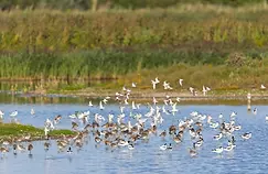
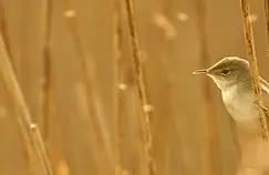
Darsham Marshes Nature Reserve | Suffolk Wildlife Trust
Nestled within the Minsmere River Valley, Darsham Marshes is a classic representative marshland site that has been traditionally managed for many years in order to achieve its diverse mix of flora and fauna.

Tosier Chocolate Maker
Tosier Small Batch Craft Chocolate Factory,
Chocolate Shop, Café and Tasting Rooms.
Come and see chocolate being made, taste exceptional single origin hot chocolate, experience a chocolate flight and tasting, book a making workshop or factory tour…
or simply pop in and pick out a special gift.

Aldeburgh Beach
the ever popular beach front still sell fresh fish straight from the fishermen, and often seals pay the shore a visit

RSPB Minsmere
With woodland, reedbeds, grassland, heathland and the wild coast to explore, you can easily spend a whole day at Minsmere. Enjoy family time pond dipping or den building in the woods. Visit the shop and enjoy delicious food on our café terrace immersed in the tranquillity of nature.

Snape Maltings
Wonderful kiosks filled with nicnacks and must haves

Southwold Beach
Award winning Southwold beach, white sands, beach front cafes, dunes and more

Leiston Steam Museum
a museum local to the campsite filled with wonders from a bygone era

Coastal Voyager Southwold
If you are looking for fun in the beautiful sleepy seaside town of Southwold you have come to the right place!! You will go a long way to beat the exhilarating experience of a ride aboard our charter RIB Coastal Voyager.

Fisher Tours
Overlooking Aldeburgh's iconic shingle beach, Fishers Gin Distillery has quickly become one of the town's most magnetic attractions. We would love to share our home, our story and, of course, our lovingly crafted gins with you.

Framlingham castle
the infamous castle upon the hill, a historic place to visit while in suffolk

Leiston Film Theatre
Leiston Film Theatre, Suffolk’s oldest cinema (est. 1914)
Proudly owned and operated by Leiston-cum-Sizewell Town Council. for details on tickets and times visit the website

Adnams Tour Southwold
There's something brewing in Southwold! Join us, for an insider's journey through the Adnams Brewery or Distillery, take time to savour a Whisky Experience or shake things up on our Cocktail masterclass. For something special take control of your own mini-still and Make Your Own Gin, or scale the heights of Southwold Lighthouse for the best view in town! Ready to explore? Welcome to Adnams!

The Cut - Halesworth
Charity run exhibition, cafe, performance space in the heart of Halesworth, an ideal visit when weather is not at its best, fun for all the family
Find something to do whatever the Weather!
The Cut - Halesworth
Charity run exhibition, cafe, performance space in the heart of Halesworth, an ideal visit when weather is not at its best, fun for all the family

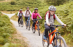
Cycling Southwold
A Guide to cycling around Southwold, within reach of the campsite.
RSPB Minsmere
With woodland, reedbeds, grassland, heathland and the wild coast to explore, you can easily spend a whole day at Minsmere. Enjoy family time pond dipping or den building in the woods. Visit the shop and enjoy delicious food on our café terrace immersed in the tranquillity of nature.
Snape Maltings
Wonderful kiosks filled with nicnacks and must haves
Framlingham castle
the infamous castle upon the hill, a historic place to visit while in suffolk
Suffolk & Essex Coast & Heaths
a wide variety of walks and trails around the counties
Darsham Marshes Nature Reserve | Suffolk Wildlife Trust
Nestled within the Minsmere River Valley, Darsham Marshes is a classic representative marshland site that has been traditionally managed for many years in order to achieve its diverse mix of flora and fauna.

National Gardens Scheme
Open Gardens across the county, visit the website for more details, times and prices
Cycling Walberswick Explorer
a Guide to a pleasant cycle ride within reach of the campsite
Cycling Dunwich and Minsmere
a guide to a Pleasant cycle ride thats easily accesible from the campsite
Aldeburgh Beach
the ever popular beach front still sell fresh fish straight from the fishermen, and often seals pay the shore a visit
Southwold Beach
Award winning Southwold beach, white sands, beach front cafes, dunes and more
Thorpeness Meare boating lake
The Meare’s shallow waters—never more than three feet deep—offer the perfect setting for children and families to explore safely. We have a wide range of boats available to suit every preference with the largest boats taking up to 6 adults.
Tosier Chocolate Maker
Tosier Small Batch Craft Chocolate Factory,
Chocolate Shop, Café and Tasting Rooms.
Come and see chocolate being made, taste exceptional single origin hot chocolate, experience a chocolate flight and tasting, book a making workshop or factory tour…
or simply pop in and pick out a special gift.
Adnams Tour Southwold
There's something brewing in Southwold! Join us, for an insider's journey through the Adnams Brewery or Distillery, take time to savour a Whisky Experience or shake things up on our Cocktail masterclass. For something special take control of your own mini-still and Make Your Own Gin, or scale the heights of Southwold Lighthouse for the best view in town! Ready to explore? Welcome to Adnams!
Aldeburgh boating lake
for miniature boating fun for all the family, set sail across the pond!
Dunwich Beach
Historic Dunwich, once the largest port in England, now home to pleasant walks, wildlife, pub, tea room and free parking
Coastal Voyager Southwold
If you are looking for fun in the beautiful sleepy seaside town of Southwold you have come to the right place!! You will go a long way to beat the exhilarating experience of a ride aboard our charter RIB Coastal Voyager.

Suffolk and Essex Coast and heaths Walking guides
The Suffolk & Essex Coast & Heaths National Landscape has some of the most appealing landscapes for walking, from leisurely strolls to keen hiking, and are a fantastic way to really get to know and explore the area at a pace that will help you see wildlife and also boost your health and wellbeing!
Fisher Tours
Overlooking Aldeburgh's iconic shingle beach, Fishers Gin Distillery has quickly become one of the town's most magnetic attractions. We would love to share our home, our story and, of course, our lovingly crafted gins with you.
Leiston Film Theatre
Leiston Film Theatre, Suffolk’s oldest cinema (est. 1914)
Proudly owned and operated by Leiston-cum-Sizewell Town Council. for details on tickets and times visit the website
Leiston Steam Museum
a museum local to the campsite filled with wonders from a bygone era
Cycling Thorpness
a Guide to a pleasant cycle ride within reach of the campsite

Star Gazing - Calendar
if the weather and moon conditions are being kind and thanks to the campsites elevated position it gives us access to wide horrizons and Darsham is in a clear skies area with very low light pollution.
Community Transport and Local Bus Services
Connecting Communities is a transport service provided by Suffolk County Council designed to help people travel around the county of Suffolk who might not have access to a regular bus service.

Click the image above to take you to the website for more information
There is also a 'Border Bus' services that runs through Darsham Village, bus stop is at the church. The 521 Service, connecting Darsham through to Aldeburgh and Halesworth. The image below will get you to the time table. Mon-Friday it runs Darsham to Aldeburgh only, Saturdays you can go both ways (Aldeburgh-Halesworth)

Click the images above to take you to the website for more information